Motorcycle Riders?

The #1 community for Gun Owners in Indiana

Member Benefits:

  • Fewer Ads!
  • Discuss all aspects of firearm ownership
  • Discuss anti-gun legislation
  • Buy, sell, and trade in the classified section
  • Chat with Local gun shops, ranges, trainers & other businesses
  • Discover free outdoor shooting areas
  • View up to date on firearm-related events
  • Share photos & video with other members
  • ...and so much more!
  • JCSR

    NO STAGE PLAN
    Site Supporter
    Rating - 0%
    0   0   0
    May 11, 2017
    9,033
    133
    Santa Claus
    So I guess nobody here has a 2 way satellite communicator?

    I was trying to decide between a Garmin InReach and a SPOT X. I ended up buying a SPOT X from Bass Pro/Cabela's.

    Garmin's InReach is a bit more robust but the SPOT X has the service plan and the features I was looking for that cost extra on the InReach.

    The 2 main features that I am looking for is the ability to have family "track" my/our movements on a map in nearly real time PLUS I also wanted some basic 2 way communications when outside of cellular areas. BOTH offer those things at the prices above.

    SPOT X offers the advantages of giving unlimited transmission of 14 pre-typed messages. So you can have some canned messages that read something like "Stopped for gas, back on the road soon", "taking an extended lunch/rest break, back on road in roughly 90 minutes" or "at the strip club with the guys, don't worry, I only have $50 in singles so I won't be out late." You get to pre-type 14 different messages so you can cover a lot of topics, even things like, "flat tire, fixing it, don't worry, back on road soon" or "need help, not injured, but the bike needs to be towed" The beauty is each one of those messages sends your coordinates.

    The Garmin InReach Mini offers similar capabilities with unlimited sending but only allows 3 "canned" messages to be stored in your file so you need to be more specific about what you have typed into your unit's file.

    Both also offer a "breadcrumb" tracking system that drops a pin on a map, with your Latitude and Longitude coordinates, that your family/friends can follow. Default setting on the SPOT X is every 10 minutes with the $12/month plan. For an added cost you can go down to 2.5 minutes. The Garmin InReach Mini requires upgrading to their $25/month plan to get this feature unless you want to pay 10-cents per pin drop, which, if you ride a lot, would end up costing you another mortgage payment on your home.

    Garmin's InReach Mini offers much better navigation aids for backcountry use, and if you are in the middle of a forest or desert and need to get out it would be the better unit. InReach Mini also uses the 66 satellite Iridium network versus the 24 satellite system used by the SPOT X so it is somewhat faster to get satellite fixes, transmissions, etc.

    Both systems have an SOS button that will alert Search & Rescue to come get you.

    Both systems have a HELP button that will alter your family friends that you have an emergency but it is not serious enough to get the search & rescue teams mobilized to help you.

    Both systems cover 100% of North America, Central America, South America and Europe. But SPOT misses some areas of central Africa, Antarctica and parts of Asia, that may be an issue for some, but not for me.

    Looking at if from the COST standpoint:
    • SPOT X = $199 + $144 annual subscription --> $343
    • InReach Mini = $349 + $300 annual subscription --> $649
    Honestly the intended usage is the prime reason to pick one or the other. Both are generally very very reliable, both have some failures.

    For a MOTORCYLE trip standpoint either one will work so no need for the extra costs associated with the Garmin. I'm also a long distance backpacker and have walked across a couple countries, but I already own a couple Garmin handheld Sat Nav units for mapping, use a compass and paper map better than most people and, at age 60 am probably not going to be backpacking the wilderness northern Canada so Garmin's InReach Mini is not really an advantage for me. I'm far more likely, now, to be nearer to civilization than farther from it so the SPOT X should provide a high level of safety, plus it gives me the convenience of communication I am looking for outside of the cellular areas.
    Samsung s9 using Google Maps here. I download the route so reception isn't issue. I'm just not that fancy. :cool:
     

    melensdad

    Grandmaster
    Rating - 94.7%
    18   1   0
    Apr 2, 2008
    24,037
    77
    Far West Suburban Lowellabama
    Yeah I can’t help in any way here. I’m reliant on my iPhone, backup is nav on Harley.
    These are emergency communication devices. Most are not very good at, if they even have, navigation. A couple have good NAV tools. Many don’t even have screens! I only know of 2 models with color screens.

    FWIW I use Scenic on my iPhone for mapping. It works off-line, allows imports of GPX files, and lets me find routes that have gravel and dirt roads. It can find ‘curvy’ routes too.
     
    Rating - 96.3%
    26   1   0
    Oct 22, 2011
    1,824
    113
    Lebanon
    These are emergency communication devices. Most are not very good at, if they even have, navigation. A couple have good NAV tools. Many don’t even have screens! I only know of 2 models with color screens.

    FWIW I use Scenic on my iPhone for mapping. It works off-line, allows imports of GPX files, and lets me find routes that have gravel and dirt roads. It can find ‘curvy’ routes too.
    I like my curves!!
     

    Indyhd

    Master
    Site Supporter
    Rating - 100%
    16   0   0
    Jan 12, 2010
    1,935
    113
    Noblesville
    I have an app on my phone called Life 360 which does the whole in time tracking. Yes, I realize you need cell service, but seems like it hasn't been an issue yet.
    If I make another trip out west, or maybe solo I think I would look into the Stop X system. The price seems affordable.

    I have an appointment for my first 4000 mile service next Saturday morning in Bedford, but would be available for a late lunch or early dinner in Monticello, or any time on Sunday would work for me.
     

    melensdad

    Grandmaster
    Rating - 94.7%
    18   1   0
    Apr 2, 2008
    24,037
    77
    Far West Suburban Lowellabama
    I have an app on my phone called Life 360 which does the whole in time tracking. Yes, I realize you need cell service, but seems like it hasn't been an issue yet.
    If I make another trip out west, or maybe solo I think I would look into the Stop X system. The price seems affordable.
    Lots of dead areas in the midwest too.

    Around Lake Superior on both side of the border we found dead zones. Trans-Canadian Highway is basically a 2 lane road through wilderness that connects small towns where service picks up before dropping off again. Lake Huron's north side might as well be uncharted. But both sides of Lake Erie and Lake Ontario have pretty good coverage, same with much of the Lake Michigan shoreline. Some dead spots along the St Lawrence Seaway. Dead spots in upstate NY, rural Penn, Ohio, Wisconsin, Michigan, Minnesota, Illinois and Indiana too. Actually pretty much every state has dead spots. If you stay along the interstates there is reliable signal, but it is no fun to run the interstates. The small towns and the 2 lane state highways are much better places to find America on a bike.

    I bought a motorcycle RAM mount for the SPOT X so I can keep the antenna clear on my motorcycle, but supposedly they are fairly reliable at sending out a tracking signal while inside a chest pocket of a motorcycle jacket. I'd prefer to keep it on me, rather than on the bike, just in case of an emergency and the bike skids one way while I skid another.

    Looks like the State of Indiana, in all its infinite wisdom is taking away our foster son and giving him to his grandma (and her ex-con husband) so he can be reunited with his cocaine using mom so we will probably run down as many of the original Mother Road (Route 66) as we can find after the baby is out of our home. Some of the original Route 66 is gone. Some is still around. Some is unpaved. Much has been diverted to other roads so we are looking to follow the original route as much as possible. It ends on a pier in California. My wife has a brother in Albuquerque and Route 66 runs right through that city, I'd be happy to go there, then maybe divert off to the Grand Canyon. Then back home. No real desire to go back to California, especially Southern CA. We will see where we end up, but I'm sure the satellite communicator will give a little peace of mind to some of my family members who can 'track' our progress.
     

    cbhausen

    Grandmaster
    Site Supporter
    Rating - 100%
    128   0   0
    Feb 17, 2010
    6,392
    113
    Indianapolis, IN
    I had a dentist appointment this morning at Fort Harrison (59th and Lee Road area). So I hopped on the bike near Eagle Creek Airpark and took Kessler all the way across to 56th Street to get there. Had a great ride both ways and even got caught in the rain just before I got home from work. Diverted to Rick’s Café Boatyard for a glass of iced tea before putting the bike in the barn. Not a bad day; the bike made getting that temporary crown much more tolerable. The DCT is still flawless, an engineering marvel that makes riding easier and more enjoyable without stealing any of the bike’s character.
     

    JCSR

    NO STAGE PLAN
    Site Supporter
    Rating - 0%
    0   0   0
    May 11, 2017
    9,033
    133
    Santa Claus
    Lots of dead areas in the midwest too.

    Around Lake Superior on both side of the border we found dead zones. Trans-Canadian Highway is basically a 2 lane road through wilderness that connects small towns where service picks up before dropping off again. Lake Huron's north side might as well be uncharted. But both sides of Lake Erie and Lake Ontario have pretty good coverage, same with much of the Lake Michigan shoreline. Some dead spots along the St Lawrence Seaway. Dead spots in upstate NY, rural Penn, Ohio, Wisconsin, Michigan, Minnesota, Illinois and Indiana too. Actually pretty much every state has dead spots. If you stay along the interstates there is reliable signal, but it is no fun to run the interstates. The small towns and the 2 lane state highways are much better places to find America on a bike.

    I bought a motorcycle RAM mount for the SPOT X so I can keep the antenna clear on my motorcycle, but supposedly they are fairly reliable at sending out a tracking signal while inside a chest pocket of a motorcycle jacket. I'd prefer to keep it on me, rather than on the bike, just in case of an emergency and the bike skids one way while I skid another.

    Looks like the State of Indiana, in all its infinite wisdom is taking away our foster son and giving him to his grandma (and her ex-con husband) so he can be reunited with his cocaine using mom so we will probably run down as many of the original Mother Road (Route 66) as we can find after the baby is out of our home. Some of the original Route 66 is gone. Some is still around. Some is unpaved. Much has been diverted to other roads so we are looking to follow the original route as much as possible. It ends on a pier in California. My wife has a brother in Albuquerque and Route 66 runs right through that city, I'd be happy to go there, then maybe divert off to the Grand Canyon. Then back home. No real desire to go back to California, especially Southern CA. We will see where we end up, but I'm sure the satellite communicator will give a little peace of mind to some of my family members who can 'track' our progress.
    Sorry to hear about the boy. An extended road trip will help with the coping. You and your wife seem like great people. Enjoy the trip.
     

    melensdad

    Grandmaster
    Rating - 94.7%
    18   1   0
    Apr 2, 2008
    24,037
    77
    Far West Suburban Lowellabama
    Sorry to hear about the boy. An extended road trip will help with the coping. You and your wife seem like great people. Enjoy the trip.
    Thanks, not sure I'm all that great but my wife certainly makes me a better person. Her initial reaction was anger. Mine was more support of her. Now mine is anger, just can't believe that the state would so strongly favor a blood relative over a better family but we knew that was the case going into this. Still just hard to believe.
     

    melensdad

    Grandmaster
    Rating - 94.7%
    18   1   0
    Apr 2, 2008
    24,037
    77
    Far West Suburban Lowellabama
    FWIW, the SPOT X 2-way satellite communicator arrived today and I got a bit of time to play with it.

    A few things:

    The screen is not backlit, so using it at night requires some sort of external light. I know other units are similar. Still, there should be some emergency light for those moonless nights.

    It takes several minutes to send off messages. This is not like texting. I knew this. It beams up to one of 24 possible satellites, which then beam back down to earth to another person's phone or email. The process can take 5 or 10 minutes. Again, totally known in advance. But what I didn't expect the messenger to follow/track me around our pool while I was sending out some test messages.

    It can only send out 3 messages at a time so if you want to send out 4 messages, you have to wait until the first 3 are gone, then you can send out the 4th message.

    The SPOT X comes with a dedicated phone number so you can have your contacts include that phone number in your contact info. They will then know that the messages are from you, not spam.

    The unit allows you to preload 14 messages. You get unlimited sending of those messages without incurring any fees. It comes with samples but I edited those better suit my needs. This is a great feature. If you have access to a computer during a long trip you can change these daily to fit your needs/plans. I wrote messages regarding food, fuel and sleep stops, emergencies, etc. I even included a statement NOT to reply to the SPOT X unless it was an emergency because I have a limited plan on 'custom' messages.

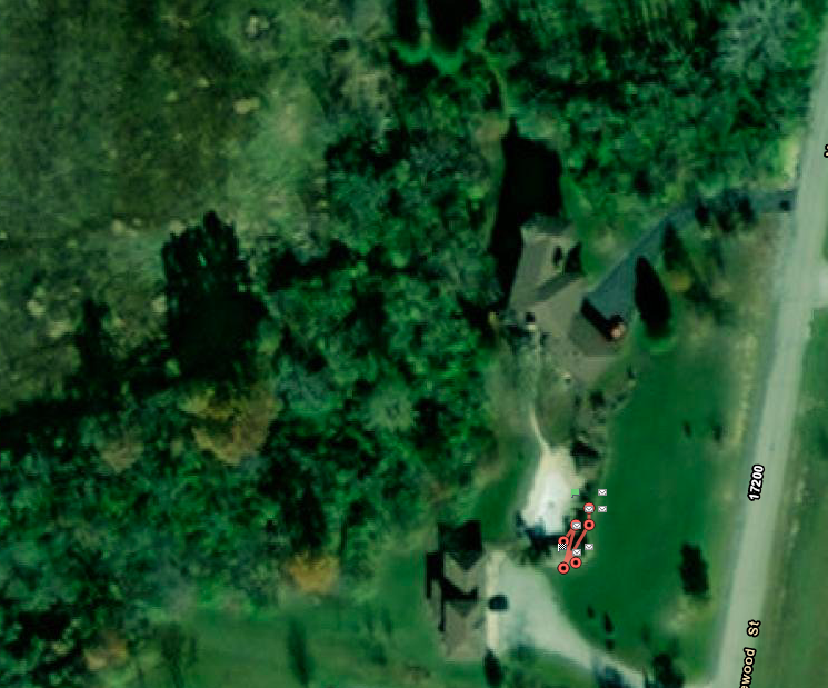
    The map below is the unit tracking me while I was transmitting from my pool deck tonight.

    Since I typically ride alone this tracking will give my wife some peace of mind while i am off exploring the wilds of Indiana/Illinois, she can live the map open on an old iPad we have and the map will get a "breadcrumb" added every 10 minutes.

    It will also give some peace of mind to our daughter and other family members when my wife and I ride on our long distance trips or do our backpacking trips. We have a Route 66 ride in planning stages and plan to hike across Wales, UK early next summer. The SOS button will work 24/7/365 regardless of cell service or location.

    Screen Shot 2021-06-28 at 11.13.50 PM.png
     

    melensdad

    Grandmaster
    Rating - 94.7%
    18   1   0
    Apr 2, 2008
    24,037
    77
    Far West Suburban Lowellabama
    We are having our foster son "transitioned" from our home. That is government talk for they are taking our baby away from us. We got him at 2 months old. He is now 16 months old. We are the only parents he know but his maternal grandmother has now been awarded custody.

    So we will have time to travel again. But where to go?

    We have seriously been looking at Route 66, but honestly leaving Chicago and heading southwest through Oklahoma, Texas, New Mexico and Arizona during the dog days of summer just seems like a stupid idea. So looking northward we are thinking maybe Nova Scotia might be a better destination, weather will be cooler, and we've never been there before.

    A round trip of 3000 to 4000 miles is reasonable and both of these destinations fit into range.

    Anyone have any other suggestions on where we should consider. Departure is city is near enough to Chicago to say we'd be leaving Chicago. So what round trip would you make if you were departing Chicago and heading off somewhere in mid-late August?
     

    tv1217

    N6OTB
    Rating - 100%
    3   0   0
    Mar 11, 2009
    10,222
    77
    Kouts
    Yeah the southwest probably isn't the best place to be in the hottest month of the year. That said, if you have plenty of water, that dry heat, although reaching and even surpassing actual numbers we only ever see as a "heat index" or "real feel" on the worst days, is far more comfortable. The Dakotas and touching into the eastern portions of the PNW is quite tolerable in the summer too. You just have the chance of running into some animals that I wouldn't want to encounter on a bike. I once almost hit a small brown bear in I think it was Montana when I was doing the OTR thing. The possibilities even being in a big semi tractor was terrifying enough.
     

    04FXSTS

    Master
    Rating - 0%
    0   0   0
    Dec 31, 2010
    1,808
    129
    Eugene
    It is not just the southwest that gets hot. Last August we took the motorhome to Idaho for a couple weeks to see in-laws. It was hot on the way out and REALLY hot on the way back. Coming across Montana the temp ran 104-106 all day. Got so hot the generator would not run, thermal shutoff, planned to stay at a Walmart but had to find a campground for power for the night. Next morning the generator ran fine and the temp across South Dakota was down in the 90's. Jim.
     

    tmschuller

    Master
    Site Supporter
    Rating - 100%
    41   0   0
    Feb 25, 2013
    2,832
    113
    Grant county
    Finally have the clutch demons gone on my bike! A bad master cylinder and hose
    Went for a ride last evening and no slipping. Hope to ride to work this week and definitely this weekend! Been a long time !
     

    melensdad

    Grandmaster
    Rating - 94.7%
    18   1   0
    Apr 2, 2008
    24,037
    77
    Far West Suburban Lowellabama
    . . . You just have the chance of running into some animals that I wouldn't want to encounter on a bike. I once almost hit a small brown bear in I think it was Montana when I was doing the OTR thing. . .
    I've dodged whitetail deer here in Indiana, one was so close that I swear I could have grabbed his tail as we passed. Not sure how I missed him other than I was standing on the rear brake and squeezing the front brake as hard as I could ... thanks to the ABS system the bike stayed upright and I barely missed the deer.

    While riding I've also had 3 encounters with Moose and that is an animal that I'd never want to hit. Seeing them at a distance is majestic, seeing them in front of you protecting a calf that is crossing a rural 2 lane road is unnerving on a motorcycle.

    SUMMER HEAT is why we are thinking about Canada. The border is opening up to vaccinated people and my wife and I qualify to cross the border and travel freely.
     
    Rating - 96.3%
    26   1   0
    Oct 22, 2011
    1,824
    113
    Lebanon
    I've dodged whitetail deer here in Indiana, one was so close that I swear I could have grabbed his tail as we passed. Not sure how I missed him other than I was standing on the rear brake and squeezing the front brake as hard as I could ... thanks to the ABS system the bike stayed upright and I barely missed the deer.

    While riding I've also had 3 encounters with Moose and that is an animal that I'd never want to hit. Seeing them at a distance is majestic, seeing them in front of you protecting a calf that is crossing a rural 2 lane road is unnerving on a motorcycle.

    SUMMER HEAT is why we are thinking about Canada. The border is opening up to vaccinated people and my wife and I qualify to cross the border and travel freely.
    On our trip to Yellowstone we encountered Buffalo in backed up traffic as they come up alongside you, you find Jesus really quick and pray they don’t get startled in any form.

    ***Do not look at them or move your head as they walk past. Tip for future Yellowstone riders from a park ranger we talked with.***
     

    EyeCarry

    Master
    Rating - 100%
    9   0   0
    May 10, 2014
    1,533
    63
    Bloomington
    ....
    Anyone have any other suggestions on where we should consider. Departure is city is near enough to Chicago to say we'd be leaving Chicago. So what round trip would you make if you were departing Chicago and heading off somewhere in mid-late August?
    Melensdad,
    You may have already gone this way but what about North to Pictured Rocks, East to Copper Harbor, then Duluth. North to Thunder Bay stopping at Kakabeka falls and then the rest of the way over Superior stopping at White River which is Winnie the Pooh's home. Then over and down to Mackinac bridge, Traverse City, Sleeping Bear dunes, down to Ludington and across lake Michigan on the SS Badger in to door county Wisconsin and then home.
    Clockwise around Superior is supposed to be one of the 8 best MC rides. I've done 3/4 of it counterclockwise. Definitely would be better clockwise.
     

    cbhausen

    Grandmaster
    Site Supporter
    Rating - 100%
    128   0   0
    Feb 17, 2010
    6,392
    113
    Indianapolis, IN
    I used to work with a guy up in Warsaw who somehow could afford a new Yamaha R-1 but not a helmet to go with it. TB and offered him one of ours (we had plenty) but he declined.

    We used to take our telescopes to the dark sky preserve up there and go observing together, which is where he told us about his encounters with whitetail deer while on the bike. He said you could see their eyes up in the woods off to the sides of the road.

    It wasn’t a week later we heard he had struck a deer while riding and was brought by helicopter to a local hospital. He was brain dead and they kept him alive long enough to harvest his organs for donation. A very sad story, he was a really cool dude and a hell of a machinist.

    Wear your helmets, folks.
     
    Top Bottom