-
Be sure to read this post! Beware of scammers. https://www.indianagunowners.com/threads/classifieds-new-online-payment-guidelines-rules-paypal-venmo-zelle-etc.511734/

You are using an out of date browser. It may not display this or other websites correctly.
You should upgrade or use an alternative browser.
You should upgrade or use an alternative browser.
Satellite Texting Device/Service
- Thread starter Magneto
- Start date
The #1 community for Gun Owners in Indiana
Member Benefits:
Fewer Ads! Discuss all aspects of firearm ownership Discuss anti-gun legislation Buy, sell, and trade in the classified section Chat with Local gun shops, ranges, trainers & other businesses Discover free outdoor shooting areas View up to date on firearm-related events Share photos & video with other members ...and so much more!
Member Benefits:

BehindBlueI's
Grandmaster
- Oct 3, 2012
- 25,897
- 113
No idea how well it works and it's very limited, but: https://support.apple.com/en-us/HT213426 if you're willing to go to an Apple cell phone and use the built in sat features. I'm somewhat disappointed Samsung didn't include this on their latest model. It's really the only thing I'd interested in upgrading for.
KittySlayer
Grandmaster
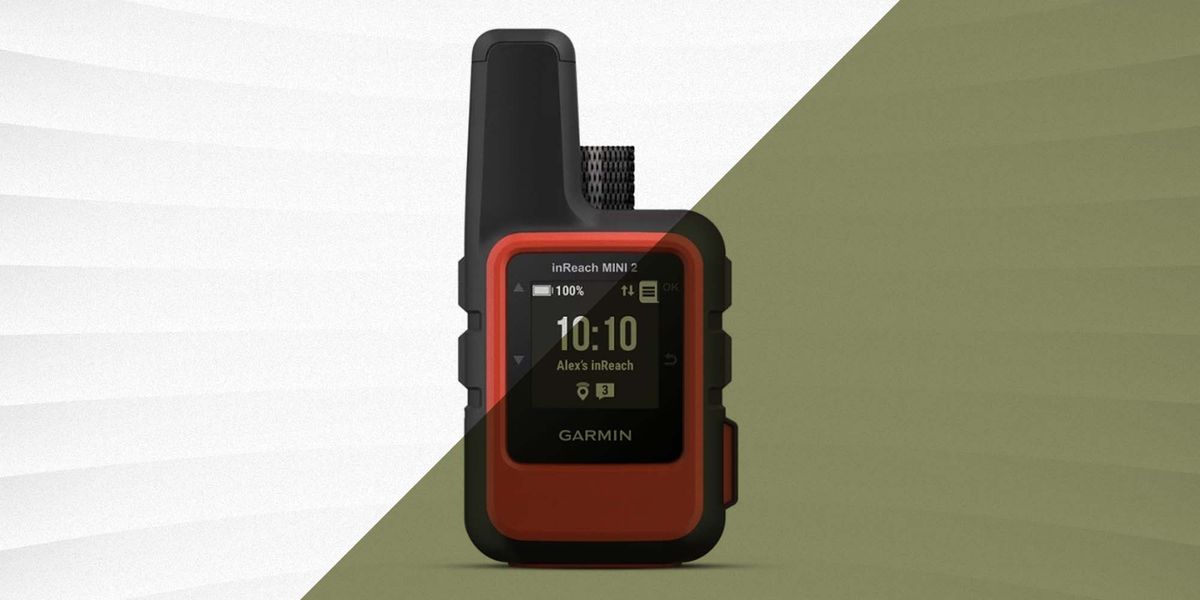
The Garmin InReach Mini will connect to your phones keyboard via Bluetooth. Keep in mind you need a clear view of the sky where the satellites are.
Inreach and spotx are actually pretty affordable if you only want to send and receive texts. A couple bucks a month (Plus ten cents ish a message for texts/check ins ) isnt too bad for the "I made it to my next campsite for the night. Heading to ___________ via _______ tomorrow. will advise when I arrive". (and they'll know when/where to send rescuers when you dont check in again)Garmin in-reach is probably going to fill the bill but hang on when you see the rate plans. If you just need it for occasional use you should rent a sat phone.
IF you just want the one way hikers equivalent to an aircraft distress/crash beacon, check out SPOT. Its a one way gizmo that lets you send a handful of canned messages (tagged with your current location) to update your followers as to your progress. And if the SHTF you can send an alert to your friends and family to have them call for rescue. (It doesnt directly send distress messages to "911" and coordinate the rescue, but relies on your support network to engage rescuers, hence the cheap price)
Stay Connected, Safe, and Worry-Free With the Best Satellite Communicators
Send texts and emails or call for help with these messengers, no matter how far off the grid you go.
Being a backpacker most of us use the garmin inreach mini or mini2. I use the inreach mini. Other popular options are the Zoleo and bivystick. For only messaging I think the zoleo is the best bang for your buck with unit cost and plans. I chose garmin for the added tracking and it integrates with my garmin fenix watch.I am looking for a device that can send texts through satellite. Preferably a device that has the keyboard built in. Long battery life is preferable but not required. I don't need many features the ability to send texts is the only real use I intend for it.
All 3 options require a phone for the keyboard but garmin does have the bigger bulkier full-size inreach with a keyboard.
Gunmetalgray
Sharpshooter
ZOLEO Satellite Communicator
Hello ZOLEO, Goodbye Coverage Gaps<br>Meet ZOLEO, the affordable accessory that extends your smartphone messaging coverage to everywhere on SCHEELS
snapping turtle
Grandmaster
I will be looking into this after my great smokie mountains dale hollow trip. The land around Burkesville in Ken Tuckie was a vast waist land of SOS cell phone signal.
We found out how much we know just set it and forget it on the phone. My portable radios we left home can there were two times they would have come in handy. The area maps of GSM we used helped us but north of dale hollow I did not have a map and drove around in a circle on the Cumberland river (not a bad lost at all).
Messed with waze a bit on the road. The police ahead and watch for car on shoulder warnings were nice. We had google maps/Apple maps/waze/GIA GPS going and to tell the truth all chose about the same routes. Only GIA GPS worked well without internet cause I had the map downloaded.
Old thread but stumbled on it.
I've been using the SPOT X for several years. On sale it can be found for about $200. Uses the GlobalStar network of Satellites, which is the same network used by Apple's iPhone14 that can also beam up an emergency distress beacon/call. GlobalStar covers all of North America, South America but not the North Pole, also covers Europe, Japan, Korea, and MOST BUT NOT ALL of Asia, also MOST of Africa and Coastal Waters. SPOT X is a stand alone device, built in keyboard like an old school blackberry. Current model has a Bluetooth connection to your phone if you want to type out on a screen instead of a physical keyboard.
Garmin InReach, Zoleo, BivyStick and a few others offer satellite service on the IRIDIUM network, it gives true worldwide coverage, including middle of the ocean and Antarctica. So if you need 100% of the globe coverage, the IRIDIUM compatible devices would be the best choice. ALL of them use Bluetooth to link your phone to your communicator, MOST of them require the bluetooth connection to your phone for messaging. The popular InReach Mini2 unit is $400 and has some stand alone messaging ability, but it is limited. The Iridium network is slightly faster than the GlobalStar network and also transmits weather reports, which the GlobalStar network does not transmit.
For 2 way communications, SPOT X plans are cheaper and have far more flexibility that the various brand's Iridium based plans. Each brand's device has strong points, each has weaker points, so assess your needs, areas of the globe where you need it to work, and its pretty easy to figure out what will work for you.
Based on my needs (remote hiking, motorcycle travel, etc) and based on my desire to have very flexible communication options, inexpensive 'breadcrumb' trail option, I chose the SPOT X. If I were to buy again today, I would probably buy the same thing.
The Garmin inReach Mini2 is very compelling, has more robust waterproofing, and better mapping and true navigation. Many consider the advanced mapping and navigation their killer function and Garmin can't be beat for that.
For anyone who might have purchased one of the brand new Motorola Defy units, which is actually a licensed product made by Bullitt in the UK, there is some potentially bad news for the long term survival of this product.
Bullitt is apparently in bankruptcy. Motorola and some of the other stakeholders are continuing the service, for now. But the future is uncertain.
Bullitt is apparently in bankruptcy. Motorola and some of the other stakeholders are continuing the service, for now. But the future is uncertain.
Curious what you ended up with?The Garmin InReach Mini will connect to your phones keyboard via Bluetooth. Keep in mind you need a clear view of the sky where the satellites are.
Personally I think the Garmin InReach Messenger is a better choice than the InReach Mini2. $100 cheaper, twice the battery life, better antenna. But it ditches the larger screen of the Mini2. Messenger also connects up via WiFi and Cellular in addition to Satellite, it will transmit via the fastest option available.
I've been using a SPOT X for several years and am still happy with it. Should it ever fail me I'll probably give a hard look at the InReach Messenger, but no sign that the SPOT X is going to die on me anytime soon. I like the dedicated phone number assigned to the SPOT X too, it simplifies communications to/from family in any emergency.
iPhone 14 and iPhone 15 offer emergency ONLY service for SOS via direct link satellite communication. But they don't offer any other form of Satellite communications.
I have a real problem with EVERY single one of "BEST" review articles, and I think I've honestly read every one that I can find. The problem is they don't dig into the actual costs of service plans. Most articles list the "basic" monthly service fee for each of the companies and the reader is left to assume that the basic plans are the same, or essentially the same. The plans are not similar, the functionality is not similar.
The reviews also typically leave out the number of "pre-set" messages you are allowed to store on your device, each of which gives you unlimited use of those "pre-set" messages. In every case, you write your own "pre-set" messages, save them, and upload them to the device so they are stored on the device itself.
FOR EXAMPLE:
- Zoleo gives you UNLIMITED use of 1 pre-set check in message
- Garmin gives you UNLIMITED use of 1 pre-set check in message + 3 additional pre-set messages
- SPOT X gives you UNLIMITED use of 1 pre-set check in message + 14 additional pre-set messages
- With Zoleo your message will read something like "Checking in, all good" and it will include your coordinates
- With Garmin you will have 4 of those messages so you can have the above "Checking in..." plus you can have "Weather great, travel is progressing as planned" plus you can have "Weather not cooperating, slow progress" plus you can have "Having some issues" or "Having a great time" or whatever.
- With SPOT X you get 14 of those messages so you can have the same as Garmin plus, things like "Spending an extra day in this spot to explore" -AND- "having some issues with equipment, but I'm good, might be delayed" -AND- "found a Titty Bar and settling in" -AND- . . . for a total of 14 messages
- With SPOT X you get unlimited tracking in the "basic" plan
- With Garmin if you use tracking with the basic plan you are going to get charged 10-cents per ping. If you hike, ride, drive, for 6 hours a day, at 60-cents per hour, that is $3.60/day. Assume a 10 day trip and you just spent $36 additional dollars on breadcrumb tracking alone.
- Zoleo charges a flat fee of $6/month for 'location sharing'
- BivyStick uses a "credit" for every breadcrumb dropped, and those credits are deducted from your 20/credits per month fee, which are shared with communications. You can literally run out of credits at lunchtime on day 1 of your trip if you drop a breadcrumb every 10 minutes.
My guess is that MOST casual users can easily get by with an $11.95/month plan while using a SPOT X, especially if you pay on an annual contract because all of your "monthly" messages are rolled over to the FIRST MONTH, so if you have a trip in month 3, 4 or 5 and just occasionally use it in the earlier or later months, you can splurge on the trip and never run out of "custom" messages, especially when combined with the UNLIMITED use of 14 "predefined messages" and the UNLIMITED 1 'check in message' and the UNLIMITED 'breadcrumb tracking' at 10 min intervals. If your travels are in the lower 48 or southern 1/2 of Canada, South or Central America, most of the European nations, and your focus is on tracking and communication then SPOT X is a compelling choice.
My guess is that MOST casual users with a Garmin InReach Messenger or InReach Mini2 will need the mid-level plan at $24.95/month on an annual contract, which is slightly more than DOUBLE the annual cost of the SPOT X plan. Now that said, if I had a boat that went off shore of either the East or West coasts, I'd grab the Garmin and pay the fee happily. If I was in the VERY FAR NORTH EASTERN Canada or Greenland, then the Garmin would also be the easy choice. If navigation was an important consideration then a Garmin would be an easy choice. Iridium's network is sometimes faster than the SPOT network and clearly has greater coverage, so that as a factor swings a choice to Garmin.
If you can't tell, I'm not a huge fan of Zoleo, especially now that the Garmin Messenger has been on the market for a year and is well tested. Also if you can't tell, I am very satisfied with my SPOT X, and despite the "limited" satellite connectivity, I'm not actually bothered by the fact that I can't use it in the middle of the Pacific ocean, or some remote region of China.
KittySlayer
Grandmaster
I got an InReach mini from a fellow INGO member. Primary use is for spouse’s peace of mind. Daily checkin and SOS feature if needed. Thru hiking the AT this year and determined I can get by with the basic plan and use cell phone for chatting when cell service is available. I do not use the navigation features.
If you utilize the other 3 pre-set messages you can do more advanced check ins PLUS it will act as a rudimentary breadcrumb trial. Each message sends your coordinates and pins your location on a map. So while the basic InReach plan doesn't include dropping pins to track your progress, it does have a work-around.I got an InReach mini from a fellow INGO member. Primary use is for spouse’s peace of mind. Daily checkin and SOS feature if needed. Thru hiking the AT this year and determined I can get by with the basic plan and use cell phone for chatting when cell service is available. I do not use the navigation features.
For example, your regular check in, can be done in the morning when you break camp, again in the evening when you stop to make camp (or a specified time every evening).
You should have 3 pre-defined messages you can program in the InReach Mini. So you can do something like 1) making good progress, weather cooperating, 2) making slow progress, things could be better, 3) not a great day today for hiking but moving forward
Each of those can be sent as needed, and will update your wife/family. Each also will include a Lat/Long Coordinate Point, so it acts as a basic breadcrumb trail on an electronic map that you can share with your wife. Should there be an issue, she can then provide "last known location" and even potential direction of travel.
If you coordinate rough "time windows" for the transmissions so that you do one in the early morning, one midday, one at dinner and one at bedtime, it also works as an informal safety net. Miss 1 of those and maybe you have heavy tree cover or simply forgot . . . miss 2 of those and the wife will know there is a problem . . . but miss 3 in a row and you wife should call the cavalry (or whatever you set up with her)
I did a section of the AT 40+ years ago! No such technology then. I did a cross England hike from the North Sea to the Irish Sea and also hiked 600 miles from Southwest France, across Spain, to the Atlantic Ocean. Having a Sat-Com can give others peace of mind.
With my tracking set at 10-minutes (while riding), I have a tablet set up in the kitchen, linked to my SPOT map. I displays my breadcrumb points along my ride, which I rarely plan in advance if I go out for a day. If I go out for a week or two I pretty much have my routes pretty well planned out with nightly destination points, etc.
Enjoy your time on the AT and good luck. That is a long one. Bill Bryson's book is a classic tale about A Walk In The Woods.
For whatever it is worth, and this does not include some of my short local trips, but this is last Sunday through today. With the truck.
But it does illustrate the electronic breadcrumbs on the map. Seems to me this feature, in the back country, would dramatically cut down a search area if the SOS button is deployed.
Set on 10 minute tracking it gives very detailed mapping of a hiking path.

And to give you an idea on how much details and accuracy you can get with the tracking, here is me, walking around my pool patio between my home and my pool shed.

But it does illustrate the electronic breadcrumbs on the map. Seems to me this feature, in the back country, would dramatically cut down a search area if the SOS button is deployed.
Set on 10 minute tracking it gives very detailed mapping of a hiking path.
And to give you an idea on how much details and accuracy you can get with the tracking, here is me, walking around my pool patio between my home and my pool shed.
Thank you, this was comprehensive and well written. I have been looking at a few different options, aimlessly. Your post has centralized my focus.Old thread but stumbled on it.
I've been using the SPOT X for several years. On sale it can be found for about $200. Uses the GlobalStar network of Satellites, which is the same network used by Apple's iPhone14 that can also beam up an emergency distress beacon/call. GlobalStar covers all of North America, South America but not the North Pole, also covers Europe, Japan, Korea, and MOST BUT NOT ALL of Asia, also MOST of Africa and Coastal Waters. SPOT X is a stand alone device, built in keyboard like an old school blackberry. Current model has a Bluetooth connection to your phone if you want to type out on a screen instead of a physical keyboard.
Garmin InReach, Zoleo, BivyStick and a few others offer satellite service on the IRIDIUM network, it gives true worldwide coverage, including middle of the ocean and Antarctica. So if you need 100% of the globe coverage, the IRIDIUM compatible devices would be the best choice. ALL of them use Bluetooth to link your phone to your communicator, MOST of them require the bluetooth connection to your phone for messaging. The popular InReach Mini2 unit is $400 and has some stand alone messaging ability, but it is limited. The Iridium network is slightly faster than the GlobalStar network and also transmits weather reports, which the GlobalStar network does not transmit.
For 2 way communications, SPOT X plans are cheaper and have far more flexibility that the various brand's Iridium based plans. Each brand's device has strong points, each has weaker points, so assess your needs, areas of the globe where you need it to work, and its pretty easy to figure out what will work for you.
Based on my needs (remote hiking, motorcycle travel, etc) and based on my desire to have very flexible communication options, inexpensive 'breadcrumb' trail option, I chose the SPOT X. If I were to buy again today, I would probably buy the same thing.
The Garmin inReach Mini2 is very compelling, has more robust waterproofing, and better mapping and true navigation. Many consider the advanced mapping and navigation their killer function and Garmin can't be beat for that.
I just realized this was actually a thing yesterday while going down the youtube rabbit hole for overlanding. Makes me wonder what else I'm missing in ingo conversations. I just need to open threads that aren't my typical subjects.
Thank you, this was comprehensive and well written. I have been looking at a few different options, aimlessly. Your post has centralized my focus.
Realistically there are only a handful of options.
SPOT X -> GlobalStar Satellite
Garmin, Somewhere, Zoleo, ACR BivyStick -> Iridium Satellite
Apple iPhone 14/15 -> GlobalStar Satellite
Motorola Defy -> Skylo (brokered group of satellites)***
Each has differences for different types of uses. Some are great for breadcrumb style tracking. Some are great for group use. Some are pure SOS options. Some offer actual navigation. Some offer weather reports. Some offer flexible communications.Each also has an SOS function to bring in the cavalry if for remote rescue, some have an automotive rescue option in addition to search & rescue SOS.
Iridium has more satellites so it is a bit faster to transmit & receive, also covers 100% of the globe. GlobalStar covers most of the globe but is not suitable for polar explorers, people in the middle of oceans and some parts of Saharan Africa or central Asia. GlobalStar has slightly slower transmit & receive times. Both Iridium and GlobalStar typically connect and transmit up to a satellite within MINUTES not instantly like we are used to with cellular texting. It can literally take 1, 3, 5 or occasionally 10 minutes to send up a message. But from remote regions they do get messages out to & from your family, and can pinpoint your (within 2 meters) on a map.
Figure out your wants and needs, prioritize them, get the best option for you.
*** Bullitt, the developer of the MOTOROLA DEFY, is a UK based company that licensed the Motorola name, it recently went into receivership, so no clue if the product will remain available. However Motorola and Skylo seem to be honoring the service agreements (for now)
I just realized this was actually a thing yesterday while going down the youtube rabbit hole for overlanding. Makes me wonder what else I'm missing in ingo conversations. I just need to open threads that aren't my typical subjects.
Lots of overlanders use these. But they can even come in handy at Indiana's Potato Creek State Park and other places where you are actually not too far from home but still have zero signal on your cell. The SPOT X is probably the largest/heaviest unit, but it easily clips onto a belt or backpack and weighs under 7 ounces and is roughly the size of a cell phone (but thicker). The Garmin InReach Mini2 is actually tiny and offers a rudimentary screen with turn by turn directions.
I got into them for snowcat trail grooming in remote areas and for motorcycling on long trips in rural areas for communications where there is no cell coverage. Pretty much every snowcat operator has these. Far fewer bikers, but most bikers don't actually ride alone or go remote.
I switch the Ram Ball set up from my motorcycle to my truck. Truck has a suction cup mount on the windshield. Motorcycle uses a bolted ball. But I simply switch twist the knob, remove the arm and mount and switch, takes less than a minute.

Last edited:
...Your post has centralized my focus.
Just an update on this, the Motorola DEFY device, which was built by British company Bullitt, and only carried the Motorola name under a licensing agreement, seems to have an issue. Bullitt went bankrupt.I just realized this was actually a thing ...
Currently Motorola and the satellite group that the Defy device used are supporting the Defy's service. But for how long? Probably not a good bet to go with the Defy device.
I'd also point out that currently Apple's iPhone 14/15 models are set up to communicate with EMERGENCY services ONLY. So no way to send 'check in' messages or similar messaging via the iPhones. They do now have several verified rescues.
Spot and Garmin each have roughly 10,000 verified rescues.
Last edited:
Quick follow up. 30 day experiment tracking my truck. This is not all my driving during a 30 day period, it is only what I did when I had the SPOT X, which I generally keep mounted in my truck on a Ram Mount.
1 trip to Michigan State University included some 'white out' snow conditions.
1 trip down thru Indiana included mostly heavy sideways rain and hail conditions.
Most trips were reasonably clear skies, mixed clouds, etc. Several commutes to Purdue University where I coach their Olympic Sport Fencing program.
SPOT X recorded 346 pin drops. While you can't zoom in on the map below, on the live map version accessible to users you can zoom into each location with an accuracy of something like 6 feet, it is apparent that the SPOT X did miss some pin drops. But not many. There are 2 or 3 places along some of the routes, only apparent when zooming into the routes, show slightly longer stretches between pin drops. The SPOT X is set to drop a pin every 10 minutes. I'd guess that maybe it failed to drop less than a half dozen 'pins' on the map during this month-long test.
So the question is, is it acceptable to miss a few pin drops? Honestly I would say YES. If I was out hiking and the pins were dropping every 10 minutes, then 'missed' a pin drop, the distances between those pin drops, at 10 minute dropping, would likely be about a 1/4 of a mile apart. At no time in my testing does it appear that it missed dropping more than 2 pins 'drops' in a row; and it appears that only happened 1 time.
So from a Search And Rescue perspective, the search crew could simply look at my SPOT map EVEN IF I DID NOT SEND AN S.O.S., but get an alert from a family member that my breadcrumbs stopped and I was missing, they could see my path, my locations and my last pin drop, which would narrow down a search area to less than 1 square mile if I was out hiking.
Assuming similar scenario, but on a motorcycle, snow machine, ATV, etc., the search crews would do the same, but, EVEN IF I DID NOT SEND out any sort of S.O.S. would have a wider search area but would still have the path until the breadcrumbs stopped.
In either scenario, if I would have sent an SOS, the coordinates of the SOS would pinpoint my exact location with LAT/LON coordinates and allows for 2 way communication with the SAR coordinators.

There are a couple GREEN check marks, those are locations where I sent a 'check in' and there are about a dozen ENVELOPES, those are locations where I sent a text message through the SPOT X. I did find that a 'check in' may(?) replace a pin drop, so both may not show on the map, but both are sent with the LAT/LON coordinates. Text messages also send the LAT/LON coordinates. All of this is included in the $11.95 basic subscription.
* Bear in mind you don't need a SPOT X for driving along most the US interstates, there is cell coverage along most our Interstate system, but this made for an easy test.
1 trip to Michigan State University included some 'white out' snow conditions.
1 trip down thru Indiana included mostly heavy sideways rain and hail conditions.
Most trips were reasonably clear skies, mixed clouds, etc. Several commutes to Purdue University where I coach their Olympic Sport Fencing program.
SPOT X recorded 346 pin drops. While you can't zoom in on the map below, on the live map version accessible to users you can zoom into each location with an accuracy of something like 6 feet, it is apparent that the SPOT X did miss some pin drops. But not many. There are 2 or 3 places along some of the routes, only apparent when zooming into the routes, show slightly longer stretches between pin drops. The SPOT X is set to drop a pin every 10 minutes. I'd guess that maybe it failed to drop less than a half dozen 'pins' on the map during this month-long test.
So the question is, is it acceptable to miss a few pin drops? Honestly I would say YES. If I was out hiking and the pins were dropping every 10 minutes, then 'missed' a pin drop, the distances between those pin drops, at 10 minute dropping, would likely be about a 1/4 of a mile apart. At no time in my testing does it appear that it missed dropping more than 2 pins 'drops' in a row; and it appears that only happened 1 time.
So from a Search And Rescue perspective, the search crew could simply look at my SPOT map EVEN IF I DID NOT SEND AN S.O.S., but get an alert from a family member that my breadcrumbs stopped and I was missing, they could see my path, my locations and my last pin drop, which would narrow down a search area to less than 1 square mile if I was out hiking.
Assuming similar scenario, but on a motorcycle, snow machine, ATV, etc., the search crews would do the same, but, EVEN IF I DID NOT SEND out any sort of S.O.S. would have a wider search area but would still have the path until the breadcrumbs stopped.
In either scenario, if I would have sent an SOS, the coordinates of the SOS would pinpoint my exact location with LAT/LON coordinates and allows for 2 way communication with the SAR coordinators.
There are a couple GREEN check marks, those are locations where I sent a 'check in' and there are about a dozen ENVELOPES, those are locations where I sent a text message through the SPOT X. I did find that a 'check in' may(?) replace a pin drop, so both may not show on the map, but both are sent with the LAT/LON coordinates. Text messages also send the LAT/LON coordinates. All of this is included in the $11.95 basic subscription.
* Bear in mind you don't need a SPOT X for driving along most the US interstates, there is cell coverage along most our Interstate system, but this made for an easy test.
And another update on the Motorola DEFYJust an update on this, the Motorola DEFY device, which was built by British company Bullitt, and only carried the Motorola name under a licensing agreement, seems to have an issue. Bullitt went bankrupt.
Currently Motorola and the satellite group that the Defy device used are supporting the Defy's service. But for how long? Probably not a good bet to go with the Defy device.
I'd also point out that currently Apple's iPhone 14/15 models are set up to communicate with EMERGENCY services ONLY. So no way to send 'check in' messages or similar messaging via the iPhones. They do now have several verified rescues.
Spot and Garmin each have roughly 10,000 verified rescues.
It still works.
You can find them at discount prices on the inter webs!!! Or pay full price at many resellers if you want to do that??? If it is new in the box, it should be good to go. And it looks like the service will continue to work for the foreseeable future.
Site Supporter

Members online
- bf5565
- tsm
- mcapo
- NHT3
- 42769vette
- citizenkane
- Damdamdon
- bobjones223
- Timjoebillybob
- mmpsteve
- alc1985
- Trebor657
- 2tonic
- devildog178
- Lacthaus
- PLANEMECH
- gassprint1
- Simon6101
- Ziggidy
- indyjohn
- thedreamer
- tude
- 04FXSTS
- ditcherman
- Comiskeybum
- 85Cosmo
- rmw250
- Knight Rider
- Twinsen
- fluffypanda
- phylodog
- wtburnette
- jedi
- nad63
- boogieman
- rwilken50
- Nacho Man
- bowhunter_1978
- SAILORGOLF46
- shootersix
- loudgroove
- Relax_36
- BJHay
- chef larry
- TLHelmer
- rwilky78
- INDY45
- frenchiectfd2203
- fireball168
- rhamersley
Total: 1,706 (members: 183, guests: 1,523)
